The loss of wild spaces happens slowly. An acre here, a hectare of deforestation there, is hardly noticeable day by day. As decades roll on, however, the loss of wilderness is vivid. Further, the global implications of this loss, as evident from the climate irregularities of this 21st century, are a constant in human life. Earth’s history is one of very slow, steady change. By studying the rock record, one observes achingly intricate relationships among climate and biodiversity. Natural processes of speciation, when given time, lead to an incredible diversity, an emergence of forms, and budding behaviors – and all this evolution can be quickly lost to the history of the cosmos. Mass extinctions reduce global variety and replace many mesmerizing forms with only a few.
Over the course of a human lifetime, protected mountains hardly change. I will personally witness little or no change in the physical and geomorphic characteristics of nature. After death, as worms and fungus recycle my body into the earth, the mountains will still stand, and their waters will still travel the same river valleys to the sea. On the scale of a few million years, however, the average amount of time we measure geologic epochs, continents rise and oceans completely disappear, change in form, and travel across the Earth.

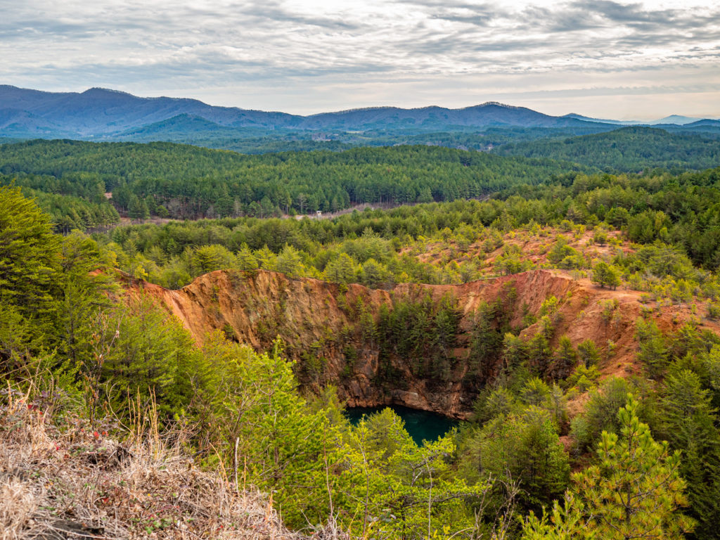
Conversely, over the course of a human lifetime, unprotected mountains change greatly. The great Hiwassee River Valley, in Southeastern Tennessee, is testament to this fact. Copper formed in the modern basin during the late Proterozoic Era, some 750 to 570 million years ago. At this time, ancient streams transported sand, clay, and gravel from a once existing massive continental land mass, known as a supercontinent, into the deep Iapetus Sea, and the sediments spread out in alternating layers on the floor of a long-extinct marine system. This pile of sediments would accumulate and harden. As the era progressed, alternating bands of sandstone, shale, and conglomerate were formed. As the sediments hardened to rock, hot fluids escaped from deep within Earth’s mantle. The fluids flowed through metal rich vents in the Iapetus Sea floor. As they emerged through the bands of forming rock, the fluids cooled as a copper ore mixed with other metals.
During the Industrial Revolution, in 1843, copper was “discovered” (worthy to note that Native Americans had long known of and utilized copper in the area) by European settlers in what’s now known as the “Copper Basin” in the tri-state area of Tennessee, Georgia, and North Carolina. Naturally, companies moved in to start mining the resource. The mines heavily extracted copper, iron, sulfur, zinc, and even some silver and gold. By the 1900s, Copper Basin, also referred to as Ducktown Basin, was the largest metal mining reservoir in the Southeastern United States. The basin was so productive in fact, that mining operations lasted until 1987.
Miners used picks, shovels, drills, and good old-fashioned elbow grease to dig out the ore. Eventually, the industry followed the veins deep into the mountains. The excavating process extracted high-quality copper, but also ore full of other associated, though not as desirable, minerals. Once the mining was complete, large smelting operations separated the copper from the rest of the ore. This process devastated the surrounding environment.
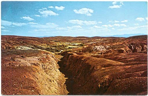
Preparing the copper was a huge undertaking that came at an incredibly high environmental cost as industry needed to separate the copper from the associated sulfur. The smelting process used at the time was called “open roast heap smelting.” The surrounding forest was clear cut, providing fodder to roast the ore for an average of three months. By the late 1800s, every tree within forty square miles of the area had been felled for the chemical burn. During the slow roast, the iron and copper disassociated from the mixture while sulfur dioxide evaporated as a gas. The sulfurous gases killed all the remaining vegetation in the area, then fell into the watersheds killing fish and causing widespread pollution. With the vegetation killed off, flash flooding followed characteristic Southern thunderstorms. These storms washed all the topsoil away. Tons of sediment eroded into the surrounding streams. The area looked like a moonscape of red clay hills and valleys – each nook laden with sulfuric smoke that was too thick to see through.
The Tennessee Valley Authority (TVA) started a long-lasting reclamation process in the 1930s. The job in front of the then new agency was daunting. After almost a century of mining and smelting, over 23,000 acres of land had been stripped to red clay. For seventy years, the TVA regenerated soil and planted more than sixteen-million trees to restore the Blue Ridge Forest, enhance water quality, and build a healthy, self-sustainable ecosystem.
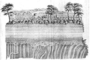
Let’s travel back in time, around sixty-five million years ago in Earth’s history, and peruse our river basin’s distant past. As an undergraduate geology student at the University of Tennessee I took one of my favorite classes in all of my collegiate career. In the spring semester of 2003, the Geology Department (now the Department of Earth and Planetary Sciences) sat on what Tennessee Volunteers refer to as “The Hill.” In a classic old brick, stone, and ivy building, I took historical geology from paleobiologist Dr. Colin D. Sumrall. In his class, I first learned about a geological unconformity. An unconformity separates two rock masses, or strata, of different ages. Put simply, an unconformity is a break in time. These structures are a geologic contact and provide evidence of deep time, tectonic forces, the evolution of life, and mass death. When I studied my first unconformity, my understanding of the world changed. Here I was, looking at rock strata of mid-Paleozoic age – a time that predates the Southern Appalachian Mountains. These rocks told me the area we know as Tennessee was once a marine ecosystem, based on all the lifeforms preserved in the strata. Many forms of marine life existed below one rock mass, preserved as fossils, above the strata only a few. A mass extinction had occurred; life had no option but to rebuild.
Our geologic era is the Cenozoic. The Cenozoic is divided into three periods: the Paleogene, beginning some 66 million years ago, the Neogene, beginning some 23 million years ago, and the Quaternary, beginning some 2.6 million years ago. Throughout the Cenozoic’s entirety, since the end of the age of dinosaurs, the Hiwassee River Basin we discuss today has been carved by running streams to craft this dramatic landscape. As the gorges here grew deeper over these periods, our very own species evolved to modern form. Today, we experience a world that began some 11,700 years ago at the end of the last major ice age. Our current epoch is the Holocene, a very stable period in Earth history. The entirety of the living world around us, including our very own human civilization, has adapted to this climate stability – to the rhythm of the seasons.
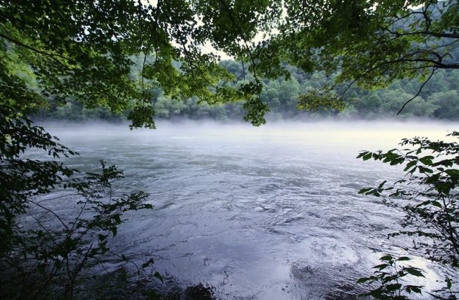
On the Hiwassee River, migrating flocks of birds and passing vegetation cruise over the old strata of planet Earth. In this age of climate change, the planetary flow of the Holocene is in jeopardy. Climate change, by the very nature of the problem, is global in scale. Global change is the most complex issue facing humanity as a species – not as a system of government, not as a national debate, but as a threat to the future of organized human society. This is the defining issue of our age. Our Holocene is on the line.
Come back tomorrow for Part 2 of Grant Mincy’s “Climate Rhythm: Evidence of Change Along the Hiwassee River”!
**2015 featured image of the Hiwassee River by Bob Henderson on flickr